Oklahoma Faces Flash Flooding, Tornado Danger As Tropical System Moves Through State
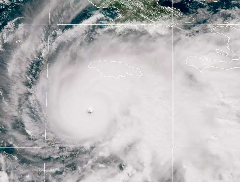
Well, like it always does, the forecast has changed quite a bit over the last few days. We're still expecting rain, but it's teetering on the edge of too much, too fast, with a big risk of flash flooding. And because when it rains, it pours, they've added a risk of tornadoes on top of it.
Our wild weather is the number one reason Oklahoma will never be a boring place.
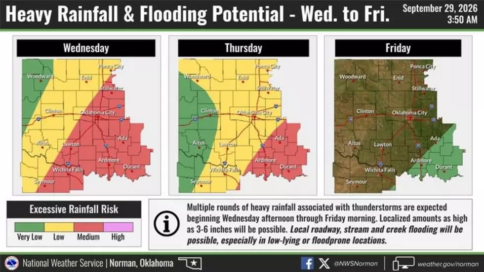
The Heavy Rain Outlook
Wednesday is going to be the heaviest day of rain as this system and cold front move through Oklahoma. Torrential downpours are very possible, which is what we don't need.
Yes, we desperately need rain, but since we're so dry in most of this area, the ground is practically hydrophobic. Moist dirt soaks up water. Dry dirt repels it. It's weird, but, you know, physics.
Flooding just became the main concern.
Mixed in with the flooding risk, there is a small chance of severe weather. Tornadoes will be possible... I mean, this is Oklahoma, twisters are a year-round thing... But this system could get a little nasty, especially if the hail cores develop like they're predicting.

That being said, while possible, the tornado risk is low. That's to say, the computer models can't all agree on what this hybrid cold front and hurricane remnant is going to do. Probably because of how rare this is.
Sure, Oklahoma's had our fair share of hurricanes and tropical storms come sweeping through. Tropical Storm Bill snapped our last bad drought back in 2015. That was the summer the entire state flooded.
Tropical Storm Erin swept up to the Sooner State in 2007 and actually intensified over us. It perplexed scientists for a long time, but both of those examples are of Atlantic hurricanes.
For one of the best examples of what could happen as Hurricane Polo passes over, we have to look way back to 1983.
Hurricane Tico followed a very similar path around the Pacific equator, intensified as it moved north, hit the Baja Peninsula, and devastated portions of Oklahoma as it swept up into the central states. The highest rain totals were measured near Chickasha, over 16 inches from that one storm.
The difference? Tico was a Category 4 storm at its strongest, making landfall as a Category 3. Polo was a Category 5, but made landfall as a Category 2. Similar enough, but stark differences.
I'm sure the forecast will change a few times as we roll through the next few days. Stay alert. Be smart. Don't drive through high water.
Oklahoma's Top Oktoberfest Celebrations
Gallery Credit: Kelso
Hunting Opportunities Across Oklahoma
Gallery Credit: Kelso
Common Oklahoma Beliefs That Aren’t Quite True
Gallery Credit: Kelso
More From KZCD-FM