NWS-Norman Warning Oklahoma Ahead of Sunday Outbreak
The old saying is "If you don't like the weather in Oklahoma, wait five minutes," and apparently that counts toward the forecast too. The National Weather Service has upgraded portions of Oklahoma to the second-highest warning level for Sunday, June 7th.
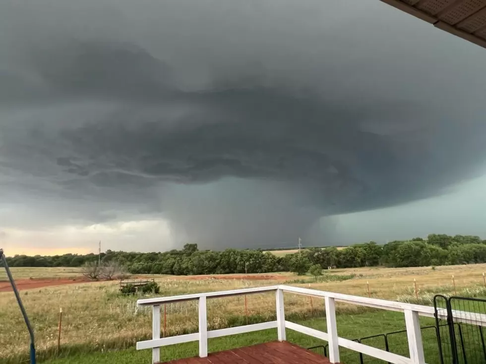
Most of the state has been issued the slight and enhanced risk categories we're all used to, but Southwest Oklahoma has been elevated to Moderate Risk for expected wild weather, a 4 out of 5 in terms of severe weather expectations.
What are the risks?
While the tornado potential is listed as low, our last tornado outbreak last Tuesday, June 3rd, with 26 tornado warnings across the state was classified as having "very low" tornado potential.
The bigger risks associated with what's coming is extremely high winds over 80 MPH and very large hail as storms roll across the plains.

Oklahoma's June severe thunderstorms are some of the most destructive of the year.
While they don't typically happen with regularity, the storms in June have just the right mix of heat, moisture, and instability to produce huge hail and devastating straight-line winds.
In June of 2023, when two massive mesocyclones collided over Lawton, it hailed for nearly two hours straight. Most of the town saw ping-pong ball-sized hail, a smaller area experienced baseball-sized stones, and we were downtown to see the monster 6-inch "DVD-sized" hail fall for nearly half an hour.
Similar big hail events happened in the years prior across the smaller Lawton-metro towns to the North - Elgin, Fletcher, Apache, Cyril, etc... Back-to-back storms in back-to-back years.
Hail isn't the only destroyer headed our way.
Wind really can be a fierce force on the plains. In June of 2018, 100+ MPH straight-line winds - AKA a derecho - came through town. The damages to trees and homes were on the same level as a really bad fall ice storm. Limbs were down, and the cleanup was slow and laborious in the summer heat.
When is it happening?
While nocturnal storms have been the theme so far in 2025, the National Weather Service is forecasting a midday start that will linger into the night. The good news is, the worst of it all should happen while the sun is up in the areas expecting the worst conditions.

While it is fun and entertaining to watch the weather coverage on TV, social media, and news outlet apps, remember that the National Weather Service issues everything to them. Anything on TV is second-hand and usually minutes behind what's provided through the NWS.
You can always keep an eye on the NWS website, whether you're area of Oklahoma is covered by the Norman office, the Tulsa office, or if you're in extreme Southeast Oklahoma, the Shreveport, LA office.
Having a NOAA radio also comes in clutch for those middle-of-the-night storms. The NWS has just completed upgrades in Western Oklahoma, so the stations are back on air now. You can set these up to fire off an alarm in your area. Believe me, they'll wake even the deepest sleepers up with severe weather warnings hit your specific area.
Best of luck. Say a prayer for your neighbors. May the force be with us all.
Things You'll Need in Your Oklahoma Tornado Prep Kit
Gallery Credit: Kelso
Odd and Unbelievable Tornado Facts
Gallery Credit: Kelso
Tornado Records from Around the Country
Gallery Credit: Kelso
More From KZCD-FM